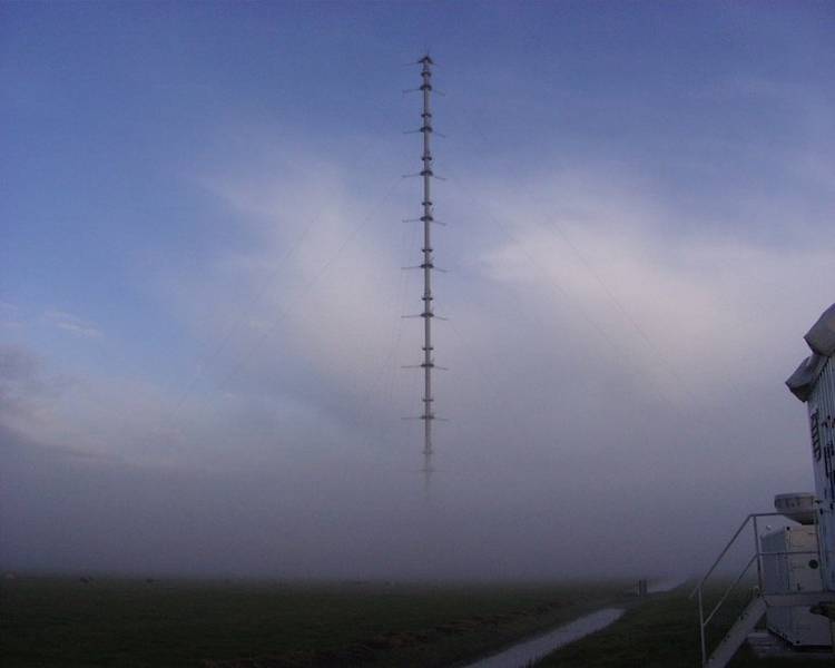
Atmospheric Boundary Layer Measurement Tower in Cabauw

Topics
- Access
- Description
- Parameters
- Coverage, spatial and temporal resolution
- Data quality
- Contact person
- References
- Data citation
Access
RESTRICTED: This data is available via the Cesar DataBase Web Portal
Description
Since 1972 the KNMI and partners have been operating a more than 200 m tall tower for boundary layer structure studies. This tower is located near Cabauw, The Netherlands, at 51.971° N, 4.927° E in a polder, 0.7 m above sea level. Besides the instruments mounted at the mast a number of additional instruments and sensor at the ground allow vertical sounding of atmosphere and clouds as well as the observation of the near surface radiation components. For more information we refer to the Cesar database web page and to the central web page of such observational data and sites in The Netherlands: Ruisdael, see references for the links.
Besides measurements of the typical parameters like wind speed and direction, air and dew point temperature at the mast itself, there is an impressive suite of additional instruments at the surface: a wind profiler [since 1994], the Raman Lidar Caeli (Cesar Water Vapor, Aerosol, and Cloud Lidar) [since 2008], and surface radiation observation station as part of the BSRN [since 2005]. At the 213 m tall tower instruments are mounted at altitudes of 10, 20, 40, 80, 140 and 200 m allowing to measure the change of wind, temperature and humidity with altitude (see references for more information).
Last update of data set at ICDC: December 2020
Parameters
| Name | Unit | since year |
|---|---|---|
| air temperature [2m, 10m, 20m, 40m, 80m, 140m, 200m] | °C | 1986 |
| dew point [2m, 10m, 20m, 40m, 80m, 140m 200m] | °C | 1986 |
| wind speed [10m, 20m, 40m, 80m, 140m 200m] | m/s | 1986 |
| wind direction [10m, 20m, 40m, 80m, 140m 200m] | deg | 1986 |
Coverage, spatial and temporal resolution
Period and temporal resolution:
- since year indicated in the table above or in the documentation
- temporal resolution: see documentation of the respective data set in the Cesar web portal
Coverage and spatial resolution:
- Local, Cabauw, The Netherlands
- Spatial resolution: none, vertical profiles
- Geographic longitude: 4.927°E
- Geographic latitude: 51.971°N
- Dimension: 1 column x 1 row x number of measurements vertically
- Altitude: (location itself is 0.7 m a.s.l.) 2 m (except wind), 10 m, 20 m, 40 m, 80 m, 140 m, and 200 m
Format:
- see documentation
Data quality
The data has gaps in the first years, and is in constant operation since Mai 2000.
Information about uncertainties and measurement errors can be taken from the documentations available via the Cesar data portal or requested directly from the responsible person.
Contact
People responsible for the data sets offered can be found here https://ruisdael-observatory.nl/cesar-database/pages/datasetsKDC.html
Stefan Kern
ICDC / CEN / University of Hamburg
E-Mail: stefan.kern (at) uni-hamburg.de
References
Websites:
- Ruisdael Observatory, https://ruisdael-observatory.nl/
- Ruisdael Observatory, Cabauw https://ruisdael-observatory.nl/cabauw/
- CESAR Observatory, http://projects.knmi.nl/cesar/
- CESAR DataBase Web Portal, https://ruisdael-observatory.nl/cesar-database/
- KNMI Data Platform (KDP), https://dataplatform.knmi.nl/open-data-info/index.html
Literature
- van Ulden, A. P., and J. Wieringa, 1996, Atmospheric boundary layer research at Cabauw. Bound. Lay. Meteorol., 78, 39-69.
- Beljaars, A. C. M., and F. C. Bosveld, 1997, Cabauw data for the validation of land surface parametrization schemes. J. Climate, 10, 1172-1193.
Data citation
Please cite the data as follows:
Cesar Observatory boundary measurements provided by KNMI Data Platform (KDP).
and with the following acknowledgments:
Thanks to ICDC, CEN, University of Hamburg for data support.
