Polar sea-ice concentration from ASI-AMSRE


Topics
- Access
- Description
- Parameters
- Coverage, spatial and temporal resolution
- Data quality
- Contact person
- References
- Data citation
Access
UNRESTRICTED:
- Get ASI-AMSRE sea-ice concentration data via FTP
- Access ASI-AMSRE sea-ice concentration data via OPeNDAP
RESTRICTED:This link to the data set is only available for a restricted user group. The data set is only accessible in CEN/MPI net or accessible from external nets with a customer account. Please contact ICDC if you would like to access this data from outside the network.
- Data access via file system: /data/icdc/ice_and_snow/asi_amsre_iceconc
Description
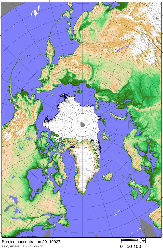
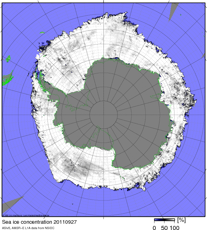
Advanced Microwave Scanning Radiometer aboard EOS (AMSR-E) data have been used to produce a finer resolved sea-ice concentration data set gridded onto a polar-stereographic grid true at 70 degrees with 6.25 km grid resolution. The sea-ice concentration data available here have been computed by applying the ARTIST Sea Ice (ASI) algorithm to brightness temperatures measured with the 89 GHz AMSR-E channels. These channels have a considereably finer spatial resolution than the commonly used lower frequency channels.
The ASI algorithm is described in Kaleschke et al. (2001) and Spreen et al. (2008), see references.
Due to a malfunction of the antenna of the AMSR-E instrument there will be no further sea ice concentration maps available in the near future. But on http://www.seaice.de and https://seaice.uni-bremen.de/sea-ice-concentration-amsr-eamsr2 you can find near-real-time daily sea ice concentration maps derived from AMSR2 data using the ASI algorithm.
So far there are no estimates of the uncertainties included in the data product.
This data set is a CliSAP/KlimaCampus product.
Last update of data set at ICDC:
Parameters
| Name | Unit |
|---|---|
| Sea ice concentration | % |
Coverage, spatial and temporal resolution
Period and temporal resolution:
- June 19, 2002, to September 30, 2011
- Daily
Coverage and spatial resolution:
- Northern and Southern hemisphere
- Spatial resolution: 6.25 km x 6.25 km, polar-stereographic grid from NSIDC, tangential plane at 70°N and 70°S, respectively
- Geographic longitude: 0°E to 360°E
- Geographic latitude: from about 41°N and 41°S to 90°N and 90°S, respectively, in the corners of the grid further equatorward
- Dimensions: 1216 columns x 1792 rows (Northern hemisphere), 1264 columns x 1328 rows (Southern hemisphere)
- Altitude: 0.0 m
Format:
- NetCDF
Data quality
The data set does not yet contain uncertainty estimates.
A number of comparisons with ship observations and independent satellite data (see publications listed below) have proven the skill of the ASI algorithm in particular for high sea-ice concentrations.
In addition a theoretical investigation about uncertainties that are expected due to sensor noise and/or varying surface and environmental conditions has been made; its results can be found in Spreen et al. (2008), see references.
We note, that the advantage given with the finer spatial resolution could be offset sometimes by the higher uncertainty of the retrieved sea-ice concentration. This is caused by the higher sensitivity of the 89 GHz channels to the atmospheric water vapor content and the cloud liquid water content when compared to the usually used 37 GHz and 19 GHz channels. In particular in the marginal ice zone sea-ice concentration could therefore exhibit a positive bias.
Contact
Lars Kaleschke
Alfred Wegener Institute for Polar and Marine Research (AWI) / Bremerhaven
email: lars.kaleschke (at) awi.deGunnar Spreen
Institute of Environmental Physics / University of Bremen
email: gunnar.spreen (at) uni-bremen.deStefan Kern
ICDC / CEN / University of Hamburg
E-Mail: stefan.kern"AT"uni-hamburg.de
References
Literature:
- Kaleschke, L., et al., 2001, SSM/I sea ice remote sensing for meoscale ocean-atmosphere interaction analysis. Canad. J. Rem. Sens., 27, 526-537. (pdf, not barrier free)
- Kern, S., et al., 2003, A comparison of two 85-GHz SSM/I sea ice concentration algorithms with AVHRR and ERS-2 SAR imagery. Trans. Geosci. Rem. Sens., 41-10, 2294-2306. (pdf, not barrier free)
- Andersen, S., et al., 2006, Improved retrieval of sea ice total concentration from spaceborne passive microwave observations using numerical weather prediction model fields: An intercomparison of nine algorithms. Rem. Sens. Environ., 104-4, 374-392.
- Andersen, S., et al., 2007, Intercomparison of passive microwave sea ice concentration retrievals over the high-concentration Arctic sea ice. J. Geophys. Res., 112, C08004, doi:10.1029/2006JC003543. (pdf, not barrier free)
- Spreen, G., et al., 2008, Sea ice remote sensing using AMSR-E 89-GHz channels. J. Geophys. Res., 113, C02S03, doi:10.1029/2005JC003384. (pdf, not barrier free)
- Wiebe, H., et al., 2009, Comparison of the ASI ice concentration algorithm with Landsat-7 ETM+ and SAR imagery. Trans. Geosci. Rem. Sens., 47-9, 3008-3015. (pdf, not barrier free)
Websites:
- Sea Ice Remote Sensing at University of Bremen, https://seaice.uni-bremen.de/sea-ice-concentration-amsr-eamsr2
- Lars Kaleschke sea ice site, http://www.seaice.de/
Data citation
Please cite the data as follows:
"ASI Algorithm AMSR-E sea ice concentration were obtained for [PERIOD] from the Integrated Climate Date Center (ICDC, CEN, University of Hamburg, Germany".
Kaleschke, L., et al., 2001, SSM/I sea ice remote sensing for meoscale ocean-atmosphere interaction analysis. Canad. J. Rem. Sens., 27, 526-537.
Spreen, G., et al., 2008, Sea ice remote sensing using AMSR-E 89-GHz channels. J. Geophys. Res., 113, C02S03, doi:10.1029/2005JC003384.
and with the following acknowledgments:
Thanks to ICDC, CEN, University of Hamburg for data support.
