Sea level SSH from C3S

Topics
- Access
- Description
- Parameters
- Coverage, spatial and temporal resolution
- Data quality
- Contact person
- References
- Data citation
Access
RESTRICTED: This link to the data set is only available for a restricted user group. The data set is only accessible in CEN/MPI net or accessible from external nets with a customer account. Please contact ICDC if you would like to access this data from outside the network.
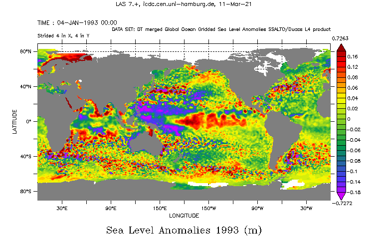
- View data at LAS (use menu for further years): MSLA
- Access data via OPeNDAP
- Data access via file system: /data/icdc/ocean/aviso_ssh
Description
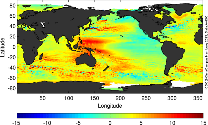
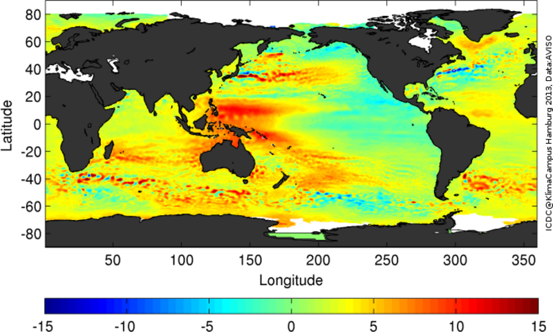
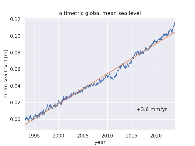
This is the successor to the former AVISO data set. After Copernicus (CMEMS) took over the AVISO DUACS mean sea surface height (MADT) and its anomaly (msla), we now provide version DT2024 of SEALEVEL_GLO_PHY_CLIMATE_L4_MY_008_057. It includes satellite altimetry data from Topex/Poseidon, Jason-1 and -2 and -3, ERS-1 and -2, Envisat, Cryosat-2, SARAL/Altika, and Sentinel-3a. This new product replaces previous SEALEVEL_GLO_PHY_CLIMATE_L4_REP_OBSERVATIONS_008_057. Compared to the previous version DT2021, this product has new input L2P altimeter standards (named vDT2024) following expert recommendations have been used for measurements of the entire time series.
The data set is based on data from two satellites throughout the entire period. The data set has daily temporal resolution for msla, madt and the surface current components u and v.
Details on the data processing can be found in the Documentation section of CMEMS website, details on the change from SEALEVEL_GLO_PHY_CLIMATE_L4_REP_OBSERVATIONS_008_057 to SEALEVEL_GLO_PHY_CLIMATE_L4_MY_008_057 can be found at the CMEMS website, too (see references).
Last update of data set at ICDC: November 13, 2025


Parameters
| Name | Unit |
|---|---|
| Mean Sea Level Anomaly (sla) | m |
| Formal mapping error (err_sla) | m |
| Surface current vector anomaly: u-component (ugosa) | m/s |
| Surface current vector anomaly: v-component (vgosa) | m/s |
| Formal mapping error for Surface current vector anomaly: u-component (err_ugosa) | m/s |
| Formal mapping error for Surface current vector anomaly: v-component (err_vgosa) | m/s |
| Absolute Mean Sea Level (adt) | m |
| Surface current vector: u-component (ugos) | m/s |
| Surface current vector: v-component (vgos) | m/s |
Coverage, spatial and temporal resolution
Period and temporal resolution:
- 1993-01-01 - 2025-04-30
- Daily
Coverage and spatial resolution:
- Global
- Spatial resolution: 0.25° x 0.25°, Cartesian grid
- Geographic latitude: -89.875°N to 89.875°N
- Geographic longitude: 0.125°E to 359.875°E
- Dimension: 1440 columns x 720 rows
- Altitude: 0.0 m
Format:
- NetCDF
Data quality
Please see the documentation at CMEMS website for information about the data quality.
In addition we would like to add the following information:
- Throughout the entire period the data set is based on (at least) two satellites. As satellites have a limited lifetime the composition of satellite data changes over time. In order to mitigate inconsistencies due to utilizing different satellites during the overlapping periods of two satellites three different satellites are used for the products. A list of which sensors have been used over which periods is given in the Product User Guide (see references).
- Poleward of 66°N and 66°S the data set relies on data from one satellite only.
- For data close to land, in shallow water areas, and close to the sea ice cover larger uncertainties occur.
Contact
C3S
copernicus-support (at) ecmwf.intRemon Sadikni
ICDC / CEN / University of Hamburg
email: remon.sadikni (at) uni-hamburg.de
References
Websites:
- CMEMS website https://resources.marine.copernicus.eu/product-detail/SEALEVEL_GLO_PHY_CLIMATE_L4_MY_008_057/INFORMATION
- Changes from SEALEVEL_GLO_PHY_CLIMATE_L4_MY_008_057 to SEALEVEL_GLO_PHY_CLIMATE_L4_REP_OBSERVATIONS_008_057 (see page 32) Dec2021_Transition_Document
- AVISO Data set, https://www.aviso.altimetry.fr/en/home.html
Data citation
Please cite the data as follows:
GLOBAL OCEAN GRIDDED L4 SEA SURFACE HEIGHTS AND DERIVED VARIABLES REPROCESSED (COPERNICUS CLIMATE SERVICE) https://doi.org/10.48670/moi-00145
and with the following acknowledgments:
Thanks to ICDC, CEN, University of Hamburg for data support.
Copernicus Licence: https://cds.climate.copernicus.eu/api/v2/terms/static/licence-to-use-copernicus-products.pdf
