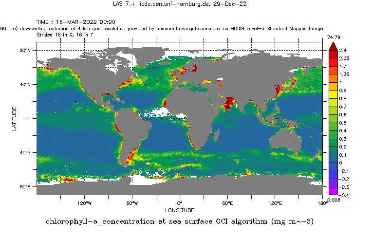
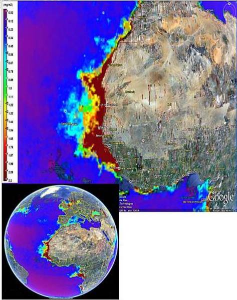
Chlorophyll-a concentration from GlobColour

Topics
- Access
- Description
- Parameters
- Coverage, spatial and temporal resolution
- Data quality
- Contact person
- References
- Data citation and License
Access
UNRESTRICTED:
RESTRICTED: This link to the data set is only available for a restricted user group. The data set is only accessible in CEN/MPI net or accessible from external nets with a customer account. Please contact ICDC if you would like to access this data from outside the network.
- View chlorophyll data with 1° resolution at LAS
- Access chlorophyll data with 1° resolution via OPeNDAP
- Data access via file system: /data/icdc/ocean/globcolour_chloro
Description
Chlorophyll-A data from ESA’s GlobColour project is available as a local copy for internal use at UHH and affiliated institutions. Product: chlorophyll-a, weighted, monthly means in 1° (index 100) and 0.25° (index 25) resolution.

The GlobColour service distributes global daily, 8-day and monthly data sets at 4.6 km resolution for, chlorophyll-a concentration, normalized water-leaving radiances (412, 443, 490, 510, 531, 555 and 620 nm, 670, 681 and 709 nm), diffuse attenuation coefficient, coloured dissolved and detrital organic materials, total suspended matter or particulate backscattering coefficient, turbidity index, cloud fraction and quality indicators. Error statistics from the initial sensor characterization are used as an input to the merging methods and propagate through the merging process to provide error estimates for the output merged products. These error estimates are a key component of GlobColour as they are invaluable to the users; particularly the modellers who need them in order to assimilate the ocean color data into ocean simulations. See the Product User Guide PUG in references for further details on the GlobColour products.
Last update of data set at ICDC:
Parameters
| Name | Unit |
|---|---|
| Chlorophyll-a concentration | mg/m³ |
Coverage, spatial and temporal resolution
Period and temporal resolution:
- 04/2002 to 08/2011
- Monthly
Coverage and spatial resolution:
- Global
- Spatial resolution: 0.25° x 0.25° and 1.0° x 1.0°, cartesian grid
- Geographic latitude: -89.875°N to 89.875°N and -89.5°N to 89.5°N
- Geographic longitude: 0.125°E to 359.875°E and 0.5°E to 359.5°E
- Dimensions: 1440 columns x 720 rows and 360 columns x 180 rows
- Altitude: 0.0 m
Format:
- NetCDF
Data quality
Please see the Product User Guide and the Validation Protocol in the references for information about the data quality.
Contact
Stefan Kern
ICDC / CEN / University of Hamburg
E-Mail: stefan.kern@uni-hamburg.de<br />(stefan.kern"AT"uni-hamburg.de)
References
Literature:
- GLOBCOLOUR Product User Guide PUG, http://www.globcolour.info/CDR_Docs/GlobCOLOUR_PUG.pdf (pdf, not barrier-free)
- GLOBCOLOUR Validation Protocol VP 2.1, 2006 (pdf, not barrier-free).
Websites:
- ESA's GlobColour Project, https://www.globcolour.info/
- HERMES GlobColor product selsection, https://hermes.acri.fr/
Data citation, License, and Acknowledgments
Please cite the data as follows:
Products processed and distributed by ACRI-ST GlobColour service, supported by EU FP7 MyOcean and ESA GlobColour Projects, using ESA ENVISAT MERIS data, NASA MODIS and SeaWiFS data.
and with the following acknowledgments:
Thanks to ICDC, CEN, University of Hamburg for data support.
License
All images and data available from the GlobColour site https://hermes.acri.fr/ are for research and educational use only.
