Observing shallow cumulus during the EUREC4A field campaign
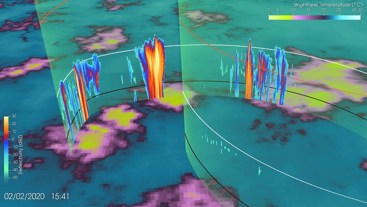
The EUREC4A field campaign took place in early 2020 in the downwind North Atlantic trade winds to study the connection between clouds, convection and circulation. Clouds of particular interest were shallow cumulus clouds that occur in different forms and arrangements. This animation shows these clouds on February 2 in a cloud arrangement that has recently been named Flowers.
The characteristic distribution of cloud patches of these Flowers can be seen in satellite images here shown as brightness temperatures captured by the Advanced Baseline Imager aboard the geostationary GOES-16 satellite (channel 13). Single patches of cloudiness at the order of 100km are separated by clear sky regions with little convection prompting questions about their formation and role in a changing climate compared to other cloud formations.
Taking a closer look at these single cloud patches with the airborne cloud radar onboard the High Altitude and Long Range Research Aircraft (HALO) the vertical structure of these cloud patches become visible. In particular the precipitating cores and thin stratiform layers that occur just below the inversion height (white line) stand out and are eponymous for this cloud pattern.
The animation shows the HALO aircraft taking off from the Barbados airport and quickly rising to the flight altitude of about 10km before sampling the atmospheric state in 200km wide circles. The sensed clouds are coloured by their radar reflectivities.More information of the EUREC4A field campaign can be found at http://eurec4a.eu/
Download the NetCDF Vertical Trajectory Profiles Reader (ParaView Plugin) used in this visualization: https://github.com/FeliciaBrisc/Python-NetCDF-vertical-trajectory-profiles-reader-for-ParaView

