ICDC
CENIntegrated Climate Data Center ICDC
Photo: UHH/Denstorf
28 February 2025, by Stefan Kern
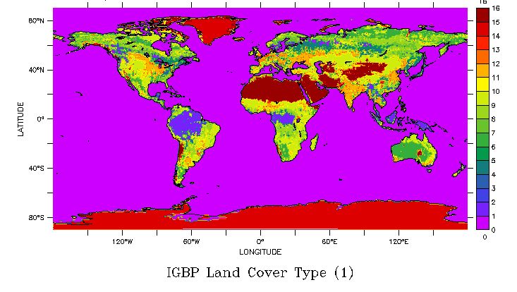
We upgraded the MODIS/SRTM land - water distribution data set from version 6.0 to version 6.1. This global data set comes on MODIS sinusoidal grid tiles with 250 m grid resolution. The time period covered (annual maps) is 2000 through 2022. This new version of this data set contains information about the type of open water; it also contains burn scar locations. For more information visit: