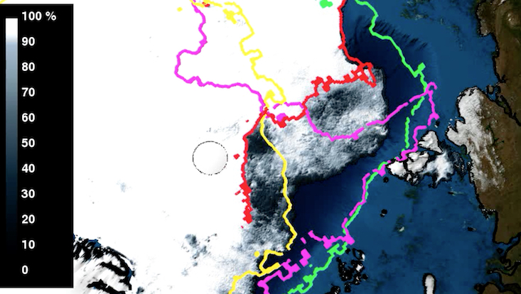
Retreat of the Arctic ice cover from July until September 2013 with Pack Ice Limits on the 10th September
Satellite measurements show a long-term decline of Arctic sea ice. The sea ice extent is usually calculated by the area of sea ice with a coverage of more than 15 percent, indicating the position of the ice edge. Particularly dense ice fields with a high degree of coverage (about 90 percent) are referred to as pack ice.
Driven by wind and currents, the ice is in constant motion. Thus, the pack ice limit is highly variable. Dense pack ice is a particular obstacle even for strong icebreakers. The limits of the pack ice, therefore, marks the practical accessibility of destinations and ship routes in the Arctic. In the animation, the pack ice limits for 2002 (green), 2007 (magenta), 2012 (yellow) and 2013 (red) are presented. The northernmost latitude reached 80.8° north in 2002, 86.26° in 2007, 87.24° in 2012 N and 88.4° in September 2013.

