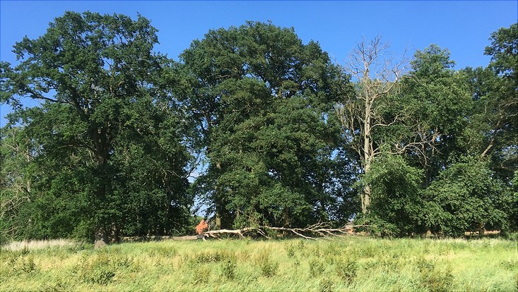
Natural Floodplains Store Carbon and Protect the Climate in the Process
18 October 2021, by Adrian Heger

Photo: UHH/CEN/Adrian Heger
Natural river habitats have become rare, although they provide effective climate and flood protection. When there is flooding, meadows and riverside woodlands provide space for the water, soaking it up like a sponge. Furthermore, by storing carbon they compensate for carbon dioxide emissions.
Together with my colleagues from Universität Hamburg’s Center for Earth System Research and Sustainability (CEN), I have investigated how much carbon alluvial soils contain. We especially analyzed which factors have the greatest influence: flooding, fallen leaves or the age of the riverside woodlands?
The area we studied is located on the lower middle Elbe – which was once characterized by species-rich woodlands, sandbanks and floodplains. Today, in many places these particularly vital hardwood floodplain forests, dominated by oaks and elms, are separated from the river by dykes. The side of the dyke facing the water is mainly covered by grassland.
Between Havelberg and Bleckede we set up 49 research sites, each with an area of 2500 square meters. They were located both in front of and behind the dyke, allowing me to compare flooded and non-flooded areas. I also investigated how woodlands and grasslands differ.
I collected roughly 1000 soil samples, digging pits 1.6 meters deep to do so. In the lab we analyzed the carbon content of the samples. The basic principle of our analysis: In our equipment, the samples are burned at a temperature of 1200 degrees Celsius. Mineral components, like grains of sand, remain intact, while humus, leaves and dead organisms are burned away. The carbon they contain is released as carbon dioxide and is collected. This allows us to determine the amount of carbon in the sample.
In order to calculate how much carbon our research areas bound per hectare, we collected additional samples using core cutters. The samples sat in the teacup-sized cutter exactly as they would in their natural setting; the plant roots, soil pores and small stones remained in place. Based on the carbon content in the samples, I used a computer model to extrapolate the amount of carbon in a hectare.
Our findings show: The areas separated from the water by the dyke contain 33 percent less carbon than those flooded by the Elbe. The particles washed away by the water contribute large amounts of carbon – seven times more than leaf litter. I found this when I compared the wooded and grassland areas. The depth of the flooding is also relevant: Lower-lying areas are more frequently flooded and are wetter due to their proximity to the Elbe. They store 50 percent more carbon than high-lying areas. The wetter the soil, the more carbon it contains, since organic material decomposes more slowly.
Conclusion: Floodplains covered by forest store the most carbon. To a depth of one meter, the soil contains an average of 124 metric tons of carbon per hectare. For comparison: In German forests, the soil binds 99 metric tons per hectare on average. That means that in the hardwood floodplain forest I investigated, the value was 25 percent higher. If the water level in the Elbe continues to fall as it has in recent years, more carbon in the form of CO2 will seep out of the soil – an aspect that I’m keeping close tabs on with the help of my measurements.
Further Information
Adrian Heger is an expert on carbon cycles in soils. He completed his doctorate at Universität Hamburg’s Center for Earth System Research and Sustainability (CEN).
Research Paper: Heger A., Becker J. N., Vasconez Navas L. K., Eschenbach A. (2021): Factors controlling soil organic carbon stocks in hardwood floodplain forests of the lower middle Elbe River, in: Geoderma. 404, 11 S., 115389. DOI: 10.1016/j.geoderma.2021.115389
Newspaper: This article was first published as a guest article in the Hamburger Abendblatt as part of a monthly series on climate research. Find all articles of the series here.


