Reliably Predicting Extreme Weather
20 August 2021, by Patrick Pieper

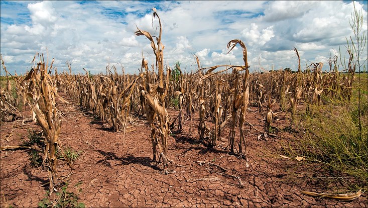
Photo: Bob-Nichols/USDA
Water shortages, parched fields, fire risks – the consequences of droughts, heat waves and other weather extremes can be devastating. Which makes it all the more important that human beings be prepared for such events in time. In this context, the sooner there are reliable forecasts, the better. Therefore, as part of my doctoral studies at Universität Hamburg’s Center for Earth System Research and Sustainability (CEN), I investigated how such weather extremes can be predicted several months in advance.
To be specific, I investigated a circulation system in the Tropical Pacific between South America and Australia. The ocean currents and air circulation there are mainly constant. However, every two to seven years the system changes: either the direction stays the same but the system is intensified; or it reverses, causing the air and ocean to flow in the opposite direction. These events, known as La Niña and El Niño, can trigger extreme weather events around the globe. But how could I predict early on whether, and if so, where, they will cause problems like droughts?
Extreme events like this could already be predicted roughly a month in advance. My aim was to extend this forecast period. To do so, I needed three things: up-to-date ocean and atmospheric data, a climate model and a high-performance computer. If I fed the data into my model, it could predict the weather for the next several months – but how reliably?

In order to check this, I first used the model to retroactively forecast past weather conditions that I knew about thanks to various meteorological reports. When the modeling data corresponded well with the actual data, it showed me that my model realistically depicted the past – which meant that it could also provide reliable forecasts for the future. However, the datasets didn’t correspond equally well in every year. On closer examination, I realized that droughts in North America could only be reliably predicted when the climate system showed a marked deviation – in other words, when a La Niña event dominated. In concrete terms: if the temperature at the water’s surface in the East Pacific is colder than average, the months of December, January and February tend to be dry in southern North America and Mexico.
This isn’t anything new. What is new, however, is that the model predictions during these anomalies are more reliable than in other years. In other words, in those times when the risk of drought is greatest, we can trust our forecasts the most.
Accordingly, I now keep a close eye on the temperature of the Pacific waters. At the first sign of an anomaly, I feed the data into my model. Then I can say exactly when, and over how great a geographical area, a drought can be expected, and up to four months in advance. That’s a real step forward, and one that gives authorities and those working in agriculture time to mitigate the worst effects.
I’m currently transferring my findings to Europe. What climate anomalies produce heat waves over Central Europe? If I can identify which climate processes lead to high temperatures, I might be better able to predict hot summers in the future – and to warn of extreme heat several months in advance.
Further information
Dr. Patrick Pieper is an expert on seasonal climate modelling at Universität Hamburg’s Center for Earth System Research and Sustainability and at the Cluster of Excellence for climate research CLICCS.
Scientific Paper
Pieper P, Düsterhus A, Baehr J, (2021): Improving seasonal predictions of meteorological drought by conditioning on ENSO states; Environmental Research Letters
Pieper P, Düsterhus A, Baehr J, (2020): A universal Standardized Precipitation Index candidate distribution function for observations and simulations; HESS


