Satellite image loops reveal volcano effects
21 March 2024, by Stephanie Janssen

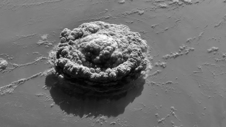
Photo: GOES-17 satellite image
The eruption of the underwater volcano Hunga Tonga in 2022 was the most explosive eruption of the past decades. Dr. Ákos Horváth used geostationary satellite imagery with a time resolution of 1 minute to characterize the generated atmospheric waves more accurately than previous studies. The method helps us to better understand wave dynamics and evaluate how strong the eruption was and how much material was ejected into the atmosphere; facts needed to calculate the climate impact.
Why do you analyze volcanic eruptions using satellite images?
Dr. Ákos Horváth: Volcanic eruptions can have great effects on weather and climate. My background is in the satellite remote sensing of meteorological clouds. But the past 5 years I have been working in a volcano project which includes colleagues from Universität Hamburg and the MPI-M. We apply well-established methods and develop new tools to provide observational input and validation data for the modeling of these climatic effects. Three major eruptions have already happened during the project: 2019 Raikoke, 2021 La Soufrière, and 2022 Hunga Tonga. They provided a large amount of valuable data.
The Hunga Tonga eruption revealed specific atmospheric acoustic and gravity waves which you took a close look at in your recent study. What effects do these waves have on the environment? Or do you use them to characterize and evaluate the current eruption?
Both. The main environmental effect of the Tonga atmospheric pressure waves was the generation of meteo-tsunamis, which accompanied traditional seismic tsunamis. These meteo-tsunamis travelled faster than the traditional ones and, thus, were missed by the existing tsunami models and warning systems. The eruption also generated a record number of lightning strikes, which formed lightning rings due to the concentrically expanding waves. The acoustic and gravity waves also caused disturbances in the upper atmosphere, which affected GPS signals. An accurate description of these waves allows the investigation of fundamental wave dynamics and helps characterize the eruption—how strong it was and how much material was ejected into the atmosphere.
What did you find out by comparing the smaller 1-minute images with the full-disk images taken every 10 minutes?
The acoustic waves travel about 200 km during the 10-minute time span between two consecutive full disk images. Therefore, the full disk images can only characterize the long-period (20 minutes or longer) components of the pressure and temperature variations. The 1-minute images, however, also capture the shorter period variations in the signal, although in a limited area. It is like zooming in on a distant object. The full disk images only ‘see’ the broad outline of the waveform shape, while in the 1-minute images the finer details of the waveform also emerge.
What is new about that, and why is it important?
Thanks to the ‘explosive’ expansion of the global observing system in recent decades (satellites, seismic and acoustic sensors, automated weather stations), the Tonga event is the best-observed volcanic eruption to date. It was incomparably better observed than the 1991 Pinatubo eruption. The rising column reached a record-setting altitude of about 57 km (Pinatubo was ’only’ about 40 km) and the event was an unusual underwater eruption, which lofted a large amount of water vapor into the stratosphere. It imparted a huge ‘shock’ to the earth-atmosphere system, similar in magnitude to atmospheric nuclear explosions, which were thankfully outlawed by the 1963 Partial Nuclear Test Ban treaty. As such, Tonga represents a once-in-a-lifetime natural experiment, which enables the evaluation and refinement of tsunami and atmospheric wave propagation models, as well as the study of the radiative and chemical effects caused by the significant increase of stratospheric water.
More information
Publication
Horváth Á, Vadas SL, Stephan CC, Buehler SA (2024): One-minute resolution GOES-R observations of Lamb and gravity waves triggered by the Hunga Tonga-Hunga Ha’apai eruptions on 15 January 2022. Journal of Geophysical Research: Atmospheres, 129, e2023JD039329. doi.org/10.1029/2023JD039329
EOS Editors Highlight:
New Insights on Atmospheric Waves from the Hunga Volcanic Eruption
DFG-funded project
VolImpact
Contact
Dr. Ákos Horváth
Universität Hamburg
CEN – Center for Earth System Research and Sustainability
Telefon: +49 40 42838-8120
Email: akos.horvath@uni-hamburg.de


