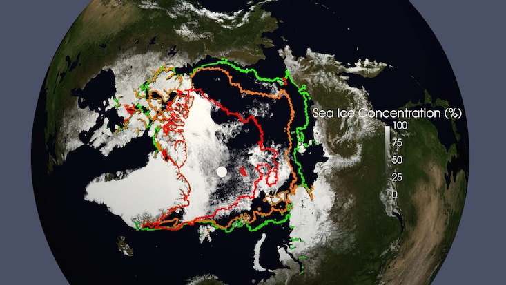
Arctic Sea Ice Melting Season 2016
During the 2015/2016 winter period in large areas across the Arctic Ocean the air temperature exceeded the long-term average by more than six degrees Celsius. In May and June of 2016, the sea ice extent was the lowest ever recorded. An unusually early break-up of the ice in the Beaufort Sea in early May contributed to these negative figures.

Arctic Sea Ice Season Melt 2016
This development can be observed in an animation based on satellite data. The data have been provided by the Japanese Weather and Climate Satellite GCOM-W1, using the microwave sensor AMSR2 (Advanced Microwave Scanning Radiometer-2). GCOM stands for Global Change Observation Mission and refers to a series of satellites for observations of the water cycle (W-Series: water and ice) and the climate (C series). The satellite W1 is the first satellite of this series providing data since the summer of 2012.
Using a new technique improved at the University of Hamburg, leads, eddies, and single large ice floes are made visible for the first time. Other methods with a coarser resolution of ice concentration can only produce details that are barely visible. The new method allows a comprehensive survey of the ice concentration in a three kilometers spatial resolution on a daily basis. The good quality can be clearly seen, for example, when observing the so-called Beaufort vortex contributing to breaking the ice. The prevailing high-pressure field in the Beaufort Sea causes the ice to move clockwise.
Since the end of August 2016 both ship passages in the Arctic are open again. In 2008 for the first time ever the Northeast as well as the Northwest Passage were navigable simultaneously. The sea ice extent at the time of the September minimum (07.09.) amounted to 4.1 million square kilometers, only slightly larger than in 2012. So far, 2012 marks the lowest ever measured ice extent in September. Once again, the long-term negative trend of Arctic sea ice extent caused by anthropogenic warming has been confirmed.
